

There are a number of common feature requests that we've resisted implementing in Icon Map until now. Three of these are all related:
- Geocoding - taking a place, postcode or address and turning it into a latitude and longitude to display on the map.
- Routing - working out how to get from point A to point B following the road network.
- Travel Time Isochrones - how far you can travel to or from a location in 5, 10 or 15 minutes, represented as a polygon.
The reason we haven't implemented these features comes down to data security. Traditionally, these services are provided as a remote API: you send the address to a remote service, it looks it up against its database, and returns the coordinates.
So why is that a problem? For many customers, it isn't. But consider that those locations might represent school children, patients or victims of crime - suddenly that data is extremely sensitive. By using a traditional geocoding service, you'd be sharing that information with a third party, potentially outside your tenant, your environment, and maybe even in a different country.
At Icon Map we've made a deliberate decision: we don't want your map data on our servers. It's the reason many of our customers use Icon Map at all - even for basic maps that could otherwise be built with the standard Power BI visuals.
So what's changed?
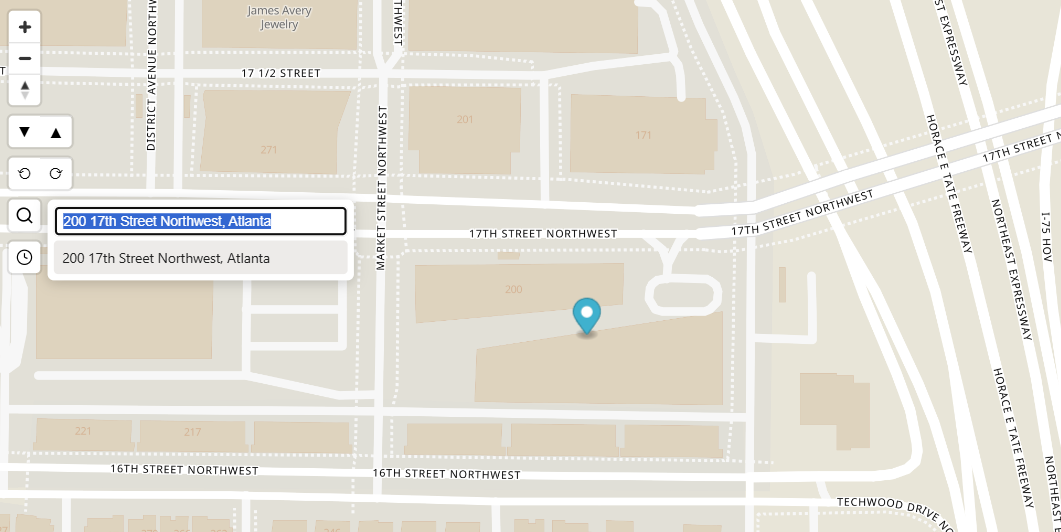
Search - Icon Map Pro and Icon Map Slicer gain a new 'Search' control. Enter a place, address or postcode and the map zooms straight to that location - almost anywhere in the world.
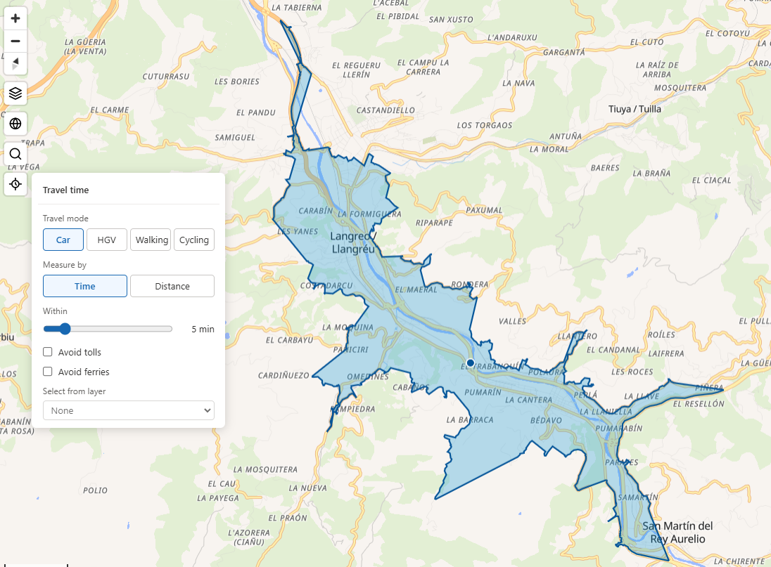
Travel time selection - Icon Map Slicer can now show travel time from a point. Choose a mode of travel - car, HGV (truck), walking or cycling - and a duration, and the control selects every item on the map that falls within the resulting isochrone.
On-the-fly geocoding - the forthcoming Icon Map for Fabric includes all of the above, and adds the ability to geocode entire datasets on the fly. Your data no longer needs to contain latitude and longitude columns - an address or postcode is enough.
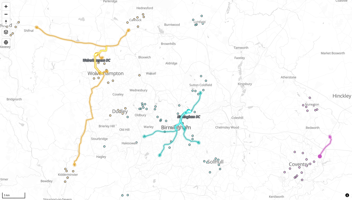
Route along the road network - in Icon Map for Fabric, the line layer has a "route along the road network" option. Specify an origin and a destination, and it generates a linestring that follows the roads.
And here's the important part: we've built every one of these capabilities without sending your location data to our servers. It all happens client-side, inside your browser - the reference data comes to you, rather than your addresses being uploaded to us.