Industry solutions · Property, construction & engineering
Why Icon Map for Property, Construction & Engineering?
Every project happens somewhere: piers rising out of a valley, lorries on the haul road, cranes over the neighbors' gardens, a portfolio spread across a region. Icon Map puts the schedule, the plant and the people on one live, interactive map, inside the Power BI reports and Microsoft Fabric workspaces you already use.
An illustrative rail viaduct in the Sauerland, Germany, on aerial imagery and 1 m terrain from the Icon Map Catalog · 3D in Icon Map for Fabric
Delivery you can see
Every activity, in its place
Schedules, progress returns, plant telematics, delivery bookings and environmental sensors already sit in your data platform. Icon Map shows them where the work happens, so a project team sees the site, not a spreadsheet: which piers are behind, where the lorries are queuing, which homes are hearing the breaker, how much is built against the plan.
Build progress, logistics and portfolio reports in Power BI with Icon Map Pro, or bring 3D models, live feeds and the time slider together in Microsoft Fabric with Icon Map for Fabric.
The build in 3D, on the real groundStructures, plant and lorries as 3D models on aerial imagery and 1 m terrain from the Icon Map Catalog, in Icon Map for Fabric.
Progress against the planPlanned and actual progress by location, and a time slider to replay the build or look ahead.
Logistics on real roadsHaul and delivery routes from Icon Map's route engine, lorries tracked through the gate, and the trips behind every pour.
Neighbors and the environmentNoise, dust and vibration monitors against their limits, beside the activity that drives them.
Infrastructure delivery · A rail viaduct in the Sauerland
A digital twin of the build
A high-speed rail viaduct across a real valley in North Rhine-Westphalia: ten 52 m spans on piers up to 54 m tall, the deck launched from a yard behind the east abutment, one segment a week. Drag the schedule to watch it rise, or play a working day to see the mixers, tippers, cranes and monitors. Click a pier or a lorry for its details. Below the map, the takt plan and the Last Planner week are linked to it: point at a location to find it on the map.
-
Takt plan by location · planned (outline) and actual, week by week
The viaduct, its schedule and the site activity are illustrative: the scheme was designed for this page, and the lorries, pours and monitor readings are simulated from its schedule. The ground is real. The aerial imagery (10 cm, Geobasis NRW) and the 1 m terrain (Geobasis NRW DGM1) come from the Icon Map Catalog, with the approach cuttings dug into the terrain as the earthworks progress. Their volumes are measured from that terrain. The lorry routes to the A45 and the quarry are computed on Icon Map's route engine. The takt plan, weekly work plan and PPC are derived from the same schedule, as a report's lean planning visuals would be from your planning data. 3D models, playback and the time slider are features of Icon Map for Fabric.
Property development · A city-center site in York
Test a scheme against the real city
Every building around the site in 3D at its measured height, with its listed grade, conservation area and flood zone, from the Icon Map Catalog. Change the scheme's height and see its shadow move through an equinox, midsummer or midwinter day, which neighbors it reaches, and how it sits against the constraints.
SchemeIts new shadowNeighbors it reachesGrade III*IIConservation area
The scheme is illustrative: nothing is proposed for this site. The buildings, their heights, listed grades, conservation areas and flood zones are real, from the Icon Map Catalog's GB Buildings layer (measured from Environment Agency LiDAR, with Historic England and OS OpenData) and the Environment Agency's flood zones. The shadow study is computed on this page from the same heights, for flat ground. 3D buildings are a feature of Icon Map for Fabric.
From one site to the whole portfolio · Icon Map Pro for Power BI
Every project, and how it is doing
A contractor's live portfolio in a Power BI report: each project as a progress ring, complete against plan and colored by its status, rolling up into clusters that show the mix of on-track and at-risk work as you zoom out. Click a sector or a status to filter the map, or a project for its numbers.
Project portfolio reportTry it: click a sector, a status or a project
Projects-The whole portfolio
Contract value-
Value behind schedule-
On trackAt riskBehindCompleteRing: complete against plan
Contract value by sector
Schedule status
Watch list
The portfolio is illustrative: real towns, invented projects and figures. Clusters with donut charts, cross-filtering and tooltips are standard Icon Map Pro features in Power BI, and work the same way in Icon Map for Fabric.
Quality and handover · A new secondary school
Every snag, where it was found
The school's CAD floor plans on the map in 3D, the walls extruded to story height, and every defect from the pre-handover inspections pinned in the room it is in. The panel filters with the map: what is still open, what is overdue, and whether the snag list will be cleared by handover at the rate it is closing.
OpenIn progressReady to inspectClosedPriority A
The school, its plans and its snags are illustrative, drawn on a real plot on the edge of Milton Keynes. The plans are shown as Icon Map's CAD import makes them, room floors and walls as polygons extruded to story height, and the snags come from your inspection or field app's data.
How it works
From the schedule to a living site
Bring in the project data
Schedule activities, progress returns, plant telematics, delivery bookings and sensor feeds flow into Fabric through Eventstream, or sit in your Lakehouse and Warehouse for history.
Eventstream · Eventhouse · OneLake
Put it on the real ground
Aerial imagery, terrain and 3D buildings from the Icon Map Catalog, your own drone surveys, site plans and CAD, and 3D models for the structure and every item of plant.
Icon Map Catalog · your surveys · your models
Run the project
Replay the build or look ahead with the time slider, follow a lorry, and measure progress, logistics and environmental performance with every chart in the report filtering together.
Icon Map for Fabric · Icon Map Pro
Project delivery, site operations and the asset portfolio
Where construction and property teams use Icon Map
Progress and schedule
Overlay 4D-BIM states and progress returns on the site, spot slippage early and protect the critical path.
Health and safety
Map accidents, near misses and inspections, and direct mitigation to the zones and activities with the highest risk.
Plant, fleet and materials
Live positions of cranes, plant, lorries and high-value materials from telematics and RFID, to cut idle time, prevent theft and allocate costs.
Traffic and logistics
Haul routes, delivery slots and gate movements on one map, to optimize deliveries and evidence the Construction Logistics Plan.
Quality and snagging
Defects, inspections and sign-offs pinned on georeferenced plans, to speed up close-out and handover.
Environmental monitoring
Noise, dust, vibration and air quality sensors against consent limits, beside the activities and homes around them.
Asset condition and maintenance
Inspection grades and defect density across the estate, to prioritize interventions and forecast whole-life cost.
Carbon and sustainability
Embodied and operational carbon by project, asset or region, supporting PAS 2080 reporting.
Stakeholder engagement
Alignments, impact zones and land take in 3D on the real landscape, for clearer consultation and smoother consents.
Risk and constraints
Geotechnical, flood, utilities, heritage and land ownership layers from the Icon Map Catalog and your own data, to de-risk early design.
Portfolio and pipeline
Current schemes, bids and KPIs across a region, with progress clusters that drill from the portfolio to a single site.
Climate resilience
Future flood and heat scenarios over the asset base, to prioritize upgrades and protect long-term performance.
Why Choose Icon Map?
Our customer success stories
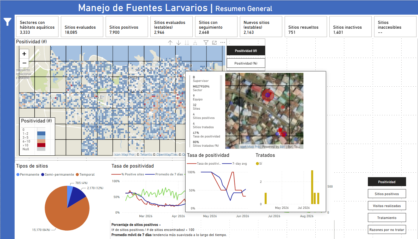
Bringing Malaria Data to Life: How MCD Global Health Uses Icon Map Pro to Power Field Decisions in Equatorial Guinea
MCD Global Health is a public health nonprofit headquartered in Maine, working across more than 50 countries to design and implement health programmes that genuinely change lives. Their international work spans malaria, cervical cancer, health systems strengt…
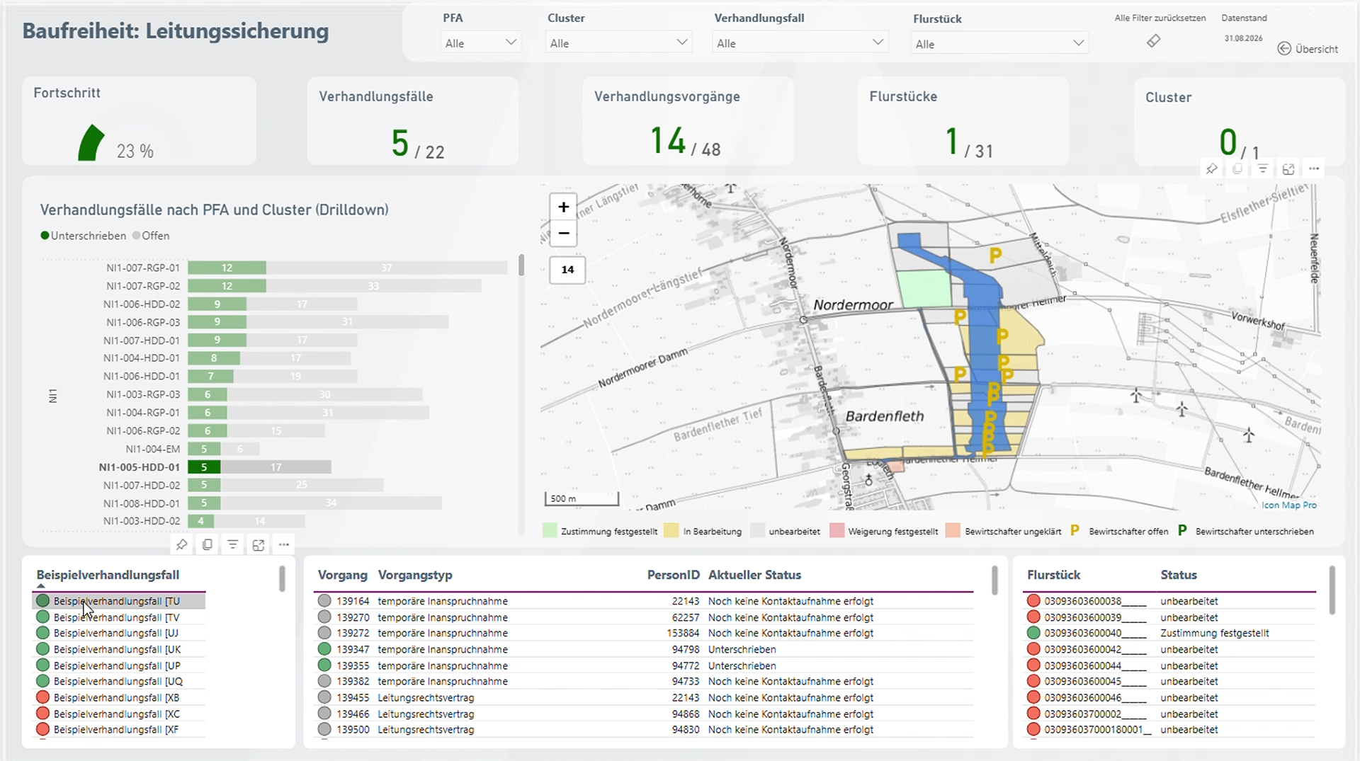
Amprion: Bringing Large-Scale Transmission Infrastructure onto a Single Map
Amprion is one of Germany’s four transmission system operators, responsible for operating and expanding a critical part of Germany’s high-voltage electricity grid. Among its major infrastructure programmes is the Rhein-Main-Link, a planned underground HVDC c…
Enhancing Fiber Deployment and Commercialization with Icon Map Pro at Orange Concessions
Orange Concessions is the leading public-private fiber network operator in rural France. Through long-term public service delegation contracts, it manages a rapidly expanding network infrastructure designed to bring high-speed broadband access to underserved…
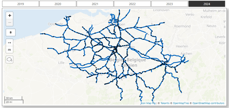
Transforming Rail Safety: The Power of Location Intelligence in Action at SNCB
Safety is a cornerstone of SNCB’s operational strategy. As Belgium’s national railway operator, SNCB places significant emphasis on the safety and security of both passengers and staff. CEO Sophie Dutordoir recently stated that all employees' work "deserves r…
Optimizing Christmas Eve: How Santa Uses Icon Map to Put Every Child on the Map
North Pole Logistics is the exclusive global operator responsible for delivering presents to children who celebrate Christmas. Operating from a single distribution center at the North Pole, the organization must reach more than 900 million homes in one extend…
Build progress, logistics and portfolio reports in Power BI with Icon Map Pro, or bring 3D models, live feeds and the time slider together in Microsoft Fabric with Icon Map for Fabric.
Play the dayPausePierConcrete placedPlanned to finish{n} days latePiling and pile capLift {n} of {m} pouredCasting the pier headCompleteTruck mixerTipperDelivery9 m³ for pier {p}Small pour: blinding, kickers and drainage9 m³ for deck segment {n}load {n} of {m}14 m³ of spoil from the launching yard, to the quarry14 m³ of spoil from the west tunnel, to the quarry14 m³ of spoil from the east cutting, to the quarryReinforcing bar, from the A45Formwork panels, from the A45Prestressing strand, from the A45Bridge bearings, from the A45Scaffold and access, from the A45On the way inUnloadingHeading backOn planpointsnoisedust (PM10)vibrationWorks start on 1 May 2025.Site set up: compound, gate and batching plantWorks corridor clearedPiling starts at {p}Pier {p} completeWest cutting and portal dug ({v} m³)Launching yard dug ({v} m³)East cutting dug ({v} m³)Launching yard readySegment {n} launched: {m} m of deck outTrack laid: the viaduct is completePoint at a location to find it on the map; click to go there on that date.Week {n} · from {d}Nothing committed this week.Six-week lookahead: {n} activities starting, {m} constraints openDoneIn progressMissedPlanned{loc}: dig and haul{loc}: bored piles{loc}: pile cap{loc}: walls and backwall{loc}: climb and pour lifts{loc}: pier head and bearings{loc}: casting bed and shed{loc}: cast the week's segmentLaunch the deck over {loc}{loc}: edge beams{loc}: slab trackEarthworksPilingPile capAbutmentPier liftsPier headYardSegment castingDeck launchEdge beamsTracktipping permit for {loc}piling rig mobilized to {loc}rebar cage for {loc}design sign-off for {loc}climbing formwork released for {loc}bearings delivered for {loc}shed steel for {loc}prestressing strand for {loc}launch jacks inspected before {loc}edge beam formwork for {loc}rail delivery for {loc}{n} projects, {v}: click to zoom inSectorContract valueComplete(planned {n}%)SchedulePlanned finishSafety{n} days without a lost-time injury{n} weeks lateFilteredThe whole portfolio{n} live projectsof the value shownNothing behind schedule in this selection.On trackAt riskBehindCompleteHealthEducationTransportWaterEnergyResidentialCommercialLocationground floorfirst floorTradePriorityA: safety or compliance, 7 daysB: function, 14 daysC: finish, 21 daysRaisedDueoverdueStatusOpenIn progressReady to inspectClosed{n} daysNo open snags in this selection.At the last fortnight's closing rate, the list is clear by {d}.At the last fortnight's closing rate, about {n} will still be open at handover.Height{n} storiesListedGrade {g}Conservation areaFlood zoneZone {n}Zone 1 (low risk)BuildingPlay the dayPauseSun {alt}° high, from {az}°.The sun is down.The scheme's shadow reaches {n} buildings now, {l} of them listed.at the equinoxon 21 Juneon 21 DecemberFlood zone 3: {p}% of the site. Needs the sequential and exception tests and a flood risk assessment.In the {a} conservation area: design must preserve or enhance its character.{n} listed buildings within 100 m, including {name} (Grade I), {d} m away.{h} m against a context median of {m} m within 100 m: {r} times.The scheme's shadow reaches {n} neighbors for 3 hours or more {d}.Show the map full screenThis live map could not load. Please check your connection and refresh the page.Use Ctrl + scroll to zoom the mapUse ⌘ + scroll to zoom the mapUse two fingers to move the map